Sunday, January 29, 2017

Setting the World on Fire?

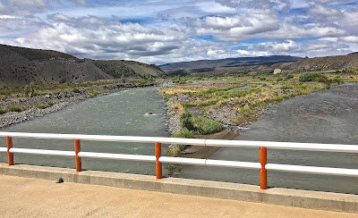
When not on fire, Chile's Mediterranean landscapes resemble California's.
In the last stages of updating Moon Patagonia, I’ve just spent ten days in Puerto Varas, leaving my bedroom/office in a friend’s house mainly to grab lunch or, when possible, enjoy a more leisurely dinner at restaurants like Almendra or Casa Valdés. In the process, I’ve only paid minimal attention to what’s happening in the rest of Chile (and the world), but that’s become unavoidable. As I drove north yesterday, past the city of Chillán on the Panamericana yesterday, the smoke from  Chile’s worst wildlife season ever became a palpable presence.
On the highway north of Chillán, the smoke obscures the landscape
Living in California, whose Mediterranean climate is a mirror image of central Chile’s, I’m more than aware of the wildfire dangers. In October of 1991, the dramatic Oakland firestorm destroyed more than 3,000 homes—some barely a mile from our own rented house—and killed 25 people. That was at the end of a long hot summer.
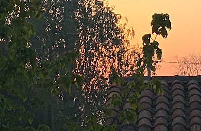
Red sky at morning: a smoky sunrise at Talca
In Chile, though, summer has barely begun—normally, the warm and dry autumn months of March and April would be the time to worry. It seems, though, that at least some of the fires here are the result of arson. In the meantime, a red sun rose over Talca this morning, and my hosts here tell me that tourist traffic has fallen off in what should be peak season.
A Muslim couple go through routine immigration procedures at Buenos Aires's international airport.

I’ll be in Santiago until Friday night, when I fly back to California to face another disaster: the disgraceful executive order from the occupant of the White House that prohibits Muslims from certain countries—even permanent residents and others with lawful visas—from entering the country. There’s been chaos at US airports and immediate resistance from civil liberties lawyers, who have obtained some injunctions against the measure, but the damage to the country’s credibility will far surpass the fire costs to Chile’s heartland. And the White House fire, we know for certain, is intentional.

Saturday, January 14, 2017

Chile's Least-Visited National Park? (Revisited)

Laguna San Rafael has the world's lowest-latitude tidewater glacier
Nearly six years ago, I wrote that Parque Nacional Laguna San Rafael, where the ice meets the sea, was Chile’s least-visited national park. The reason, I argued, was that although many people see Laguna San Rafael, they usually do so from the sea, and never set foot in the actual park. This was always a bit of hyperbole, since some remote Chilean parks like Parque Nacional Corcovado—which does not appear in any statistical summary—rarely get any visitors at all. As I recently learned, though, Laguna San Rafael gets quite a few more visitors than I expected, for reasons I’ll explain in the succeeding paragraphs.
The road up the Valle Exploradores
Until the last few years, the only way to see the massive tidewater glacier has been via an expensive cruise or catamaran excursions, but now there’s an alternative. Recently, in the lakeside hamlet of Puerto Río Tranquilo, I made arrangements for a combination overland/sea excursion to the park that allows visitors to go ashore (and some to overnight in comfortable accommodations). Sadly, the next day’s weather forecast forced cancellation of the trip and, with a tight itinerary, I was unable to reschedule.
Hikes to the Ventisquero Grosse glacial overlook start from the reception area at El Puesto
The Ventisquero Grosse, as seen from El Puesto's overlook
However disappointed, I decided to drive up the Bahía Exploradores road the next morning, to the point where the Laguna San Rafael excursions sail. I had been up the road once before, but another twenty kilometers were now open in a stunningly verdant area where glaciers approached the road (though, on this cloudy day, they were not visible. I made a brief stop at the German-run Campo Alacaluf, an isolated roadside lodge where I had stayed once before, and the proceeded up the valley past the outpost of El Puesto, a trekking company that’s built a trail to a nearby glacial overlook.
A new sign marks the entrance to the national park
Thomas Poppitz, Alacaluf’s hospitable German owner, had surprised me with the news that Conaf, the agency in charge of Chile’s national parks, had built a ranger station along the road which, I had never quite realized, marked the park boundary. Thus, without knowing it, I had actually set foot in the park at least a decade earlier. I stopped to speak with the Conaf ranger on duty and he told me that, although Conaf does not collect a park access charge here, it does so indirectly from agencies like El Puesto because the glaciers and vicinity are part of the park.
Conaf's new ranger station along the Exploradores road

Thus, in a sense, the statistics on visitation to Laguna San Rafael (4,728 according to the 2015 survey) are still misleading, though it remains true that most people see the great tidewater glacier—still the park’s biggest attraction—from the sea. That said, I’m still waiting on the day that I can walk the trail alongside the intact ice, hopefully before it recedes too far.
Smaller and larger icebergs break off the receding glacier constantly

Wednesday, December 28, 2016

Walking to Argentina and (Part Way) Back

Many years ago, when I was a geography grad student at Berkeley, my mentor Bernard Nietschmann stressed the significance of participant observation fieldwork in the anthropological tradition of Franz Boas, Margaret Mead and others. I followed his advice, if not quite with his activist immersion, in my own academic work on environmental conservation in northernmost Chile and cultural-historical geography of the Falkland Islands. Since leaving academic life for travel and guidebook writing, I’ve done that to some degree, but a few days ago I had a sardonically amusing experience in that vein.
Chile Chico, as seen from the panoramic overlook of Plaza del Viento
Throughout most of my travels in the Southern Cone countries, I’ve had the advantage of owning an automobile, which has often freed me from air and bus timetables. Last week, though, I found myself in the Patagonian border town of Chile Chico with the need to cross into Argentina for the day without using my car. Unfortunately, the usual minibus shuttles to the town of Los Antiguos have stopped running because of a punitive Argentine tax that makes the route economically unviable, so I needed an alternative means of getting there.
The bus station at Los Antiguos is where many travelers on Ruta 40 start or end their  adventure in Argentine Patagonia.
The border crossing here is an important one for backpackers, as Los Antiguos is the endpoint for buses from the more southerly Argentine Patagonia destinations of El Calafate and El Chaltén (and, conversely, the starting point for southbound travelers on Argentina’s Ruta Nacional 40). With no shuttles, though, travelers without their own vehicles are having to walk roughly four miles (6.5 kilometers) between the Argentine and Chilean border posts, and this is where my “participant observation” comes in.
The Río Jeinimeni separates Argentina (left) from Chile (right)
It’s another six kilometers or so from Chile Chico proper to Chilean customs and immigration—probably less than a mile from the Argentine post as the crow flies, but for the waters of the Río Jeinemeni—so I decided to drive and leave my car there. En route, I saw several backpackers walking toward the border post even though local taxis can take up to three passengers there for about US$10. After parking, carrying only a daypack, I left Chile and started walking south toward the bridge across the river.
As I left Chile, a line of Argentine vehicles waited to cross the border for shopping
Fortunately, it was a mild day with relatively gentle winds and, as I left the border complex, there was a lineup of vehicles waiting to enter Chile (cross-border shopping is a popular activity for Argentines even when there’s no holiday). En route, I met at least ten backpackers, including a 71-year-old Israeli, who were trudging in the opposite direction. After an hour and a half, I reached the Argentine border post and then took care of business in Los Antiguos, updating some key information and paying for a pasta lunch with a packet of Argentine pesos still in my wallet.
The Argentine border post at Los Antiguos
Then I started walking back and, shortly thereafter, I noticed that a series of markers indicated that, for Argentines, a parallel trail to the actual border was part of a “Stations of the Cross” memorial and that I had just passed “Jesus falls down.” My cross wasn’t that hard to bear—I’m not a believer, anyway—but, about a mile from the Chilean border post, an Argentine family in a pickup truck stopped to offer me a lift. Having already walked at least 10 miles, I decided to accept and spoke briefly with them about their shopping trip to Chile Chico—another form of participant observation, I guess, though it made my own story a bit less epic.
Only toward the end of my walk did I realize that, for the faithful, it was part of  a "Stations of the Cross" route

Later, in Chile Chico, I visited a bicycle rental and tour company and learned that they allow clients to ride into Argentina. As a daily recreational cyclist at home in California, I’ve missed that while I’ve been in Chile, and I had to reflect on a missed opportunity.
Had I realized that I could have taken a rental bike across the border, I would have done so
Custom Search