Showing posts with label Astronomy. Show all posts

Sunday, December 13, 2020

Corona v. Corona? Virus Meets Eclipse in South America

In mid-2019, Chileans and many foreigners flocked to the coastline, about 500 km north of Santiago, to see a major solar eclipse—a once-in-a-lifetime opportunity for most people. Tomorrow, though, there’s yet another chance, but this year’s event has complications for eclipse-chasers in Argentine Patagonia or southern mainland Chile, the path on which the moon will blot out the sun for a little over two minutes. Those complications have to do with COVID-19, of course, but also the weather.

The path of Monday's eclipse

While people flocked to the 2019 event, that comes with risks this year. A friend in Pucón, who until very recently worked in hotel administration, tells me that the city “is living as if this wave won’t arrive here. There are lots of people who’ve come to see the eclipse, many of whom surely are carrying the virus that will force us to shut down again, perhaps all summer…”

Monday's forecast shows a 90 percent chance of rain at the hour of totality,


Ironically enough, they may be risking their lives—and those of others—for nothing. A few years ago, I and some friends had to cancel an overflight of nearby Volcán Villarrica because heavy cloud cover set in the morning of our departure, and tomorrow’s forecast shows rain throughout the day (the marine west coast climate resembles that of Seattle). In the path of totality, the sky will get darker at 1 p.m., but no one there is likely to see the startling sight of the solar corona (spoiler—it’s nothing to do with the virus!) when the moon blocks the sun.


In theory, visibility should be better on the Argentine side of the border, in the rain shadow of the Andes, but rain is also possible at San Martín de Los Andes, a prime tourist destination that lies barely outside totality. Conditions should be better in the city of Neuquén, a bit farther from the path of totality, but I would expect heavy southbound traffic towards the hamlet of Picún Leufú, which lies within. A 20-something friend of ours in the city (which is not really a tourist destination) at first sounded indifferent when I asked him if he were going to watch it, but now it seems he’ll at least step outside the office to glimpse the partial eclipse.


For those of us unable to reach Chile or Argentina for the event, the National Aeronautics and Space Administration (NASA) will follow it online starting at 9:40 a.m. Eastern Standard Time. There will also be a live show in Spanish starting at 10:30 a.m. EST.

Thursday, July 11, 2019

This Year's Eclipse (and Next Year's?)

Chilean eclipse-chasers filled the beach at Caleta Los Hornos (photo by Marializ Maldonado)
I couldn’t attend last week’s solar eclipse in Chile but, indirectly at least, I had a sort of presence. When my longtime friend Marializ Maldonado, at whose house I often stay when in Santiago, asked to borrow my car to drive north to the Coquimbo region, I immediately said yes, and she was able to view the event at the beachside locale of Caleta Los Hornos, north of the city of La Serena.
In the minutes before totality, at Caleta Los Hornos (photo by Marializ Maldonado)
Partly, this was a favor to a friend, but it was also a favor to me, as it’s best not to leave a car unused for months, as I do by necessity in the outskirts of Santiago. Marializ also often does me the favor of paying my highway tolls as, for some incomprehensible reason, Chile’s online payment system does not want to accept my US credit cards (though I use them regularly when I visit Chile).
The Coquimbo region is home to major international observatories such as Cerro Tololo (CTIO), part of the US National Optical Astronomy Observatory.
Marializ arrived just five minutes before totality, which she described as “two intense and beautiful minutes” on the Pacific shoreline. The most vivid account I’ve read, though, came from the New York Times, whose “52 Places” columnist Sebastian Modak saw the event from the European Southern Observatory at La Silla—also pointing out that this was only the third eclipse to pass over a major international observatory in the last 50 years.

The eclipse turned out to be an economic bonanza for the region. According to the local daily El Observatodo, the event attracted more than 300,000 people over five days, and those visitors spent more than US$82 million. Many if not most arrived by private car, presumably from Santiago as Marializ did, but there were also numerous foreign eclipse-chasers. Plenty of people also witnessed it from the Argentine side of the border, though cloud cover obscured things in Buenos Aires.
Path of next year's eclipse
There's no guarantee of clear weather as next year's eclipse passes over Volcán Villarrica.
For Chileans and others who missed this year’s eclipse, there’ll be another chance soon enough. On December 14th of 2020, the moon will once again block the sun in the southern lakes resort district around Lago Villarrica and the town of Pucón, but that area’s marine West Coast climate—resembling Seattle’s—mean that clear skies are no sure thing. A few years ago, some friends and I planned to do a small plane flyover of Volcán Villarrica’s steaming crater but, after several days of fine clear weather, the clouds moved in the next morning and made the flight impossible. Across the Andes, where Argentina’s Patagonian steppe usually has clear skies, could be a better option.
Next year, the rain-shadow steppes of Argentina's Neuquén province might be a better place to observe totality.

Saturday, May 18, 2019

Chasing Chile's Eclipses...Across the Andes, Perhaps?

Many times I’ve visited north-central Chile’s desert regions—Coquimbo, Atacama and Antofagasta—which are home to some of the world’s most important astronomical observatories. There is also a constellation of smaller community observatories that offer visitors a chance to see the austral night skies through what, not that long ago, would have been professional telescopes.
The clear skies around Cerro Tololo Observatory (upper left here) an ideal for astronomy.
Combarbalá is one of many town and cities eagerly anticipating July's eclipse.
That said, I’ve never seen a solar eclipse there or elsewhere in South America, even though Chile (and Argentina) experienced major events in 1994 and again in 2010. There’ll be another opportunity soon, though, in the best of all possible areas—on July 2nd, the path of totality will pass directly over the city of La Serena and the Coquimbo region, home to Cerro Tololo and several other observatories. Even area beyond totality expect to take advantage of the event, as I learned last month when I visited the town of Combarbalá, which lies just south of the path.
The July eclipse's path takes it over the Coquimbo region and into Argentina's San Juan Province.
On the Argentine side, totality will pass over the Humid Pampas and just south of Buenos Aires, but winter weather could obscure the event.
From Coquimbo the path then trends southeast, crossing the Andes to the Argentine province of San Juan—another ideal viewing location for its clear desert skies—and continuing toward Buenos Aires. The eclipse will not be total in the Argentine capital, though it will be—theoretically at least—in parts of Buenos Aires province. Theoretically, I say, because that part of the Humid Pampas has a good chance of heavy cloud cover and rain in mid-winter. The skies will darken, certainly, but there’s no guarantee of seeing the moon cover the sun.

Either way, I won’t see this year’s eclipse because I’ll be in California and, in the days leading up to it, we’ll be hosting our Argentine nephew Manuel, his wife Ivana, and their son Simón. They’re flying back to Buenos Aires on July 1st, and I’m not sure whether they’ll arrive in time for the big event. I suspect that a lot of Porteños will leave the city, if just for the day, to spend some time in totality, especially if the weather seems likely to cooperate.
The map here indicates the 2019 eclipse coverage at various locations throughout Chile.
The map here indicates coverage during the 2020 eclipse. 
Even if you (or I) won’t see this one, there’s another upcoming opportunity. On December 14, 2020, Chile will experience another total eclipse in the southern mainland region of La Araucanía, passing over the prime tourist towns of Pucón and Villarrica. The downside is that, like the Pacific Northwest, this area enjoys a marine west coast climate that can bring cloud cover and drizzle at any time of year. It might be better seen in Argentine Patagonia, as the rain shadow of the Andes usually means clear skies on the sprawling steppes. It can get windy there, though, so the beach resort of Las Grutas might be the comfiest option.
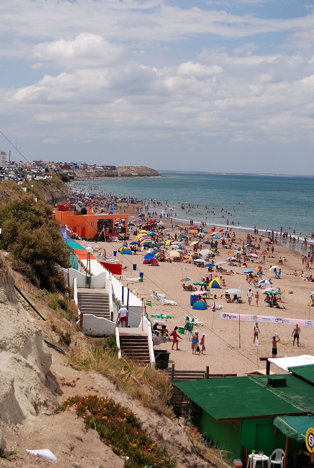
For the 2020 eclipse, it won't quite be high season at Las Grutas.

Tuesday, April 30, 2019

I've Never Been to Spain?

I’ve never been to Spain. Well I have been, I guess, if you count Catalonia as part of Spain, because I once spent a week in Barcelona. But I’ve been to Salamanca…oh, wait, not that Salamanca! Earlier this month, I spent two nights in the Chilean city of Salamanca, which I’d visited before, but this was an escape from Santiago after spending most of the previous two months in Patagonia.
Gregorio de la Fuente's "Abrazo de los Pueblos" still decorates the now disused passenger  terminal of Los Andes' Ferrocarril Transandino.
How did I get to Salamanca? Well, I started slow, thanks to late-rush hour traffic out of Santiago, but then headed north to the town of Los Andes, where the Ferrocarril Transandino once carried passengers and freight across the Andean divide to Mendoza. I had no intention of visiting Argentina this time, but I did want to see the mural by Gregorio de la Fuente—his "El Abrazo de los Pueblos” (Embrace of the Peoples) at the old train station is a celebration of Argentine-Chilean friendship. It was just a brief stop, though I did learn that there’s now an occasional tourist train on this route.
Vehicles pass along the old railroad route through Túnel La Grupa, near the town of Cabildo.
Symbolically, at least, trains played a role in my route to Salamanca, as I took the paved highway west to the town of San Felipe and then north through scenic Andean foothills that resemble the higher, drier parts of Southern California. There are only scattered settlements along this route E-71, which leads to the town of Cabildo; there, a traffic light controls access through the Túnel La Grupa, one of a series of tunnels that belonged to the Longino, the Ferrocarril Longitudinal that connected La Calera (west of Santiago) to the nitrate mines and ports of the northernmost Atacama Desert.
The landscape here resembles the higher, drier areas of Southern California.
I’d driven this route before, but not for several years. In the interim, authorities have either paved—or begun to pave—much of it north of the border between Region V (Valparaíso) and Region IV (Coquimbo). This is significant because most of Coquimbo’s population resides along the coast, where cities like Los Vilos and La Serena attract beachgoers from Santiago, and this is a more adventurous (if slower) alternative to lesser-known points.
Túnel Las Palmas marks the border between the Valparaíso and Coquimbo regions.
Café Quarzo is one of few roadside services here.
There are few services on this stretch of “highway” but, surprisingly, one enterprising local has opened a small café on the northbound descent from Túnel Las Palmas, which marks the regional border. She sells ground coffee drinks—in a country where Nescafé is often still the default option—as well as juices and mineral souvenirs (hence the name Café Quarzo). The road continues, passing several railroad bridges, to the enigmatically named village of Caimanes (there are no carnivorous aquatic reptiles here, though; the name apparently comes from an indigenous Mapundungun [Mapuche] word meaning “six condors”).
Carnivorous aquatic reptiles do not populate the area around Caimanes.
Túnel Las Astas is the last of three short tunnels north of Caimanes.
The foundations of the old railroad station still stand here, but there’s no more obvious evidence until a short distance north, where the road passes through three short tunnels with no traffic lights. Several years ago, in Argentina, I met two US cyclists who’d taken this road on my guidebook recommendation and loved it, but they confessed their trepidation in riding through the narrow tunnels, with little room to dodge any oncoming vehicle. That said, this route remains a potentially great ride for adventure-seeking cyclists.
The old train station at Limáhuida is now a country store.
Emerging from the Túnel Los Astas, the road continues to Limáhuida, where the old train station is now a small market and fading wooden workshops still stand below it. That’s also where a new bridge crosses the Río Choapa and leads east to Salamanca, where I spent two nights at the modern and comfortable Hotel Recanto, on the eastern outskirts of town.
Hotel Recanto is full during the week, but nearly empty on weekends.
Oddly—or not—I was virtually the only guest in contemporary accommodations with spacious rooms, solar-powered hot water, and an outstanding restaurant. That’s because it clears out on the Thursday and Friday, as mining managers—there are large copper deposits in the area—leave for the weekend.
Farm-fresh garlic spreads at Salamanca's central plaza
Salamanca's old train station is now a museum and part of a pleasant public park.
Nevertheless, the hotel was still walking distance from a handsome central plaza with a lively crafts and farmers market, a former train station turned museum and municipal park, and easy access to nearby petroglyphs. There are also wineries in the area, though I didn’t get to visit those, but Salamanca—where I’d stayed once several years earlier, still struck me as a good weekend getaway.
The pre-Columbian petroglyphs at Cerro Chalinga are walking distance from downtown Salamanca.
It’s not the area’s only attraction, though. The next day I took the paved highway north to Combarbalá, a village which, on the face of it, resembles some Mexican villages, with narrow streets lined by adobe houses and even ranchera music. To get there, I did veer northwest off the more direct but still unpaved railroad route (though, had there been tunnels, I would have taken it again).
The fountain at Combarbalá's central plaza represents indigenous Diaguita motifs.
Mexican ranchera music is popular in rural Chile, including Combarbalá.
Small-scale mines extract combarbalita for local crafts workers.
What Combarbalá does have is small-scale mining for the semi-precious gemstone combarbalita (I visited a local mine, thanks to Paola Yáñez of Inti Wasi Tour), and the community astronomical Observatorio Cruz del Sur, which offers nighttime tours in one of the best possible areas for professional and amateur astronomy. I stayed at the cozy Eco-Hostal Alto Algarrobal, one of many accommodations that will fill up in for July 2nd, when a total eclipse of the sun will pass nearby (Combarbalá will be slightly south of totality).
The approach to Observatorio Cruz del Sur, in the daylight hours.
The beginning of a nighttime tour at Observatorio Cruz del Sur
Combarbalá and other nearby towns will fill up for the July 2nd eclipse.
After a night at Combarbalá, I headed the next morning for the coast, where Los Vilos would make an ideal beach break for Santiaguinos returning to Chile’s capital. For my part, I continued along the coast to Viña del Mar and Valparaíso, which will be another story here in the near future.

Saturday, April 14, 2012

Rain? In the Atacama?

The Atacama has the reputation of being the world’s driest desert. If I recall correctly – I don’t have access to my home library right now - the venerable South American Handbook once asserted that some weather stations in the region had never recorded any precipitation.
Nevertheless, I recall hitchhiking once from Calama to San Pedro de Atacama in weather that turned from cloudy to near whiteout on the high plateau between the two localities.  Still, it surprised me Thursday morning when, as I loaded the car for the long drive south toward Santiago, a solid cloud cover stopped any sunlight from filtering onto the desert floor.
It wasn’t totally surprising, as the high peaks along the Bolivian border (pictured above) almost always sport some snow, and the area surrounding San Pedro had a wet summer that damaged backcountry roads. For the entire month of February, that kept the village’s travel agencies from offering excursions like the geysers at El Tatio. While it didn’t rain much in San Pedro proper, the runoff from the high country ate away at riverside roads near town, and even briefly isolated the Hotel Alto Atacama (pictured below), where I recently spent a couple nights.
When I first drove from the four or five km from San Pedro to the Alto Atacama, there was one shallow river ford that posed no problems whatsoever. Two days later, though, there were four separate fords and, while I had no problems with my high-clearance vehicle, smaller cars were taking a high-speed head start to ensure getting across the water. While I doubt that was necessary in this instance, it’s not hard to imagine problems with increased runoff – anywhere in any desert, flash floods can cause fatal accidents.
Driving west, toward Chile’s even more arid coastline, I expected the weather to clear, but I was wrong – between San Pedro and Calama, sprinkles wetted the windshield sufficiently that I had to use the wipers. Between Calama and the nitrate ghost town of Oficina Chacabuco (pictured above) , where I stopped to update my photo library, I found fine spray from heavy mining trucks obscuring the view – a virtually unheard of occurrence here. Only when I reached the coastal cordillera of the Sierra Vicuña Mackenna (pictured below) , near the Cerro Paranal observatory, did the skies clear noticeably, but even then there was lingering cloud cover.
As nightfall approached and I arrived at the town of Bahía Inglesa - roughly 740 km (460 miles) from my starting point – the sprinkles started again. They let up, though, and I slept soundly after roughly 12 hours behind the wheel (including sightseeing breaks). When I awoke the next morning, though the sun was out, I found the car spotted with sprinkles and nearly surrounded by standing water that had flowed downhill toward the beach.
Instead of taking the new freeway east and south toward Copiapó, Vallenar and La Serena, I decided to take the coastal road south toward the port of Huasco and then east to Vallenar. It’s mostly a consolidated dirt surface but, given how quickly the desert absorbs or evaporates moisture, I never expected to find miles of standing water – small amounts, admittedly – and mud. There were various crossings of the sandy bed of the Río Copiapó where, however, authorities have placed warning posts for various water levels – green means anyone can cross, yellow is for high-clearance vehicles, and red means nobody should even try.
While I can’t say it was alarming, a bit of slipping and sliding got me to slow my speed and, when I arrived at Huasco for a fresh fish lunch, my 4WD was pretty dirty. I continued south to La Serena and the charming town of Vicuña, home to Chile’s major pisco producers and clear skies that make it home to both several astronomical observatories. It was another long day on the road, covering even a little more distance than I did the day before.

Fittingly for the day, cloudy skies postponed an 8:30 p.m. visit to Mamalluca, where tourists go to see the southern constellations through professional telescopes, but an hour later the skies had cleared. This morning, the mud was still falling off the flaps of my 4WD, a reminder that desert driving has its hazards.

Wednesday, May 25, 2011

Nostalgia for the Atacama


Nearly 30 years ago, I spent almost a year in northernmost Chile, where the Atacama Desert is the world’s driest. It’s not quite true that it never rains in the Atacama, as director Patricio Guzmán states in his new documentary Nostalgia for the Light, but that’s not quite true - I’ve experienced light rain in Antofagasta and snow in San Pedro de Atacama, and precipitation increases with altitude and from west to east.

In fact, when I lived in the Aymara Indian village of Parinacota (pictured above), 4,392 meters (14,409 feet) above sea level, on the Bolivian border east of the coastal city of Arica, we had frequent thunderstorms and occasional whiteout snowstorms - in summer. Summer is the rainy season there and, though Arica itself almost never gets rain, precipitation from the Andes can rush through the deep canyons and cause flash floods on the coast.

That said, I’ll grant Guzmán artistic license for his hyperbole in a skillfully crafted cinematic essay that ties together the themes of astronomy, archaeology and the yearning for transparency and closure in the aftermath of General Augusto Pinochet’s dictatorship - many of whose victims disappeared into the vast Atacama. It’s a credit to Guzmán, who also documented Pinochet’s 1973 coup against the government of the late President Salvador Allende in The Battle of Chile, accomplishes this without indulging in polemics. The photography and cinematography, of course, are magnificent.

I can’t possibly summarize Nostalgia for the Light with Guzmán’s eloquence, but its theme is the will to interpret and even confront the past. Astronomers do so by gazing through telescopes - the Atacama is home to several major international observatories such as the European Southern Observatory's Cerro Paranal (pictured above). Archaeologists do so by excavating ruins and analyzing artifacts and even human remains found on or beneath the desert surface, in a climate whose nearly absolute aridity preserves them perfectly. In fact, archaeologists and physical anthropologists have involved themselves in identifying remains from mass graves such as the one at the isolated coastal village of Pisagua (pictured below), which also served as an inescapable prison camp.

Still, it’s the families of the disappeared, in search of their loved ones, who have been the force behind the search - sometimes testing the barren desert surfaces with trowels and shovels - and Guzmán makes them central figures in the film. Chilean astronomer Gaspar Calas, meanwhile, points out that we are always looking at the past - even a conversation at the dinner table involves delays, despite the speed of light and sound.

If there’s one criticism I could make, it’s that Guzmán (born 1941) romanticizes the Chile of his youth as almost a carefree, conflict-free country. While he points out the often-poor working conditions and injustices of nitrate mines such as Oficina Chacabuco (which were really company towns with an authoritarian organization), he seems to suggest that Chile had overcome such problems when he was a kid. Certainly Chile was stable by Latin American standards, but problems such as inequitable land tenure in the heartland intensified class tensions and encouraged the rise of Allende and others far who were far more extreme.

Still, I strongly recommend Nostalgia for the Light and, if you go to Chile, visiting several of the locations Guzmán used. Among them is Oficina Chacabuco (pictured above), which the dictatorship used as a prison camp; Guzmán interviews several former prisoners, one of whom was an amateur astronomer who taught his fellow prisoners about the night sky to help create a feeling of solidarity among them.

And of course there are the observatories, most notably Cerro Paranal, about which I have written in another post, and Las Campanas. At the end of the day, though, the most affecting single sight is a stark cross-studded amphitheater that stands in the desert east of Calama, on the road to San Pedro de Atacama. Each of its columns represents a prisoner executed here during General Sergio Arellano Stark’s so-called Caravana de la Muerte (Caravan of Death). Sadly, this Parque para la Preservación de la Memoria Histórica (Park for the Preservation of Historical Memory) does not merit a mention, nor even appear on the maps, in the widely sold Chiletur Copec series of guides and road atlases. It does appear, however, on the Chilean government's list of human rights memorials.

If you have found this article informative, please consider clicking on one or more of the AdSense links that accompany it - always presuming, of course, that it’s a product or service that interests you.

Saturday, May 15, 2010

Eclipsing the Bicentennial: Easter Island and Patagonia

In a little over a week, Argentina will begin celebrate the bicentennial of the Revolución de Mayo, the 1810 uprising against the Spanish Crown that resulted, six years later, in a formal declaration of independence at the northwestern city of San Miguel de Tucumán. Starting next week, the city of Buenos Aires - where the revolution started - will be host to a series of commemorative events, including the reopening of the emblematic Teatro Colón on the 24th.

Likewise, Chile is celebrating its bicentennial this year, though the main celebrations will take place during mid-September’s Fiestas Patrias - when Chileans celebrate their own independence day on September 18, In reality, it’s really a week-long celebration that fills even the streets of Santiago with huasos (Chile’s approximate counterpart to the gaucho) in the saddle, couples dancing the cueca, and fondas (street food stands) that offer traditional food and refreshments. Like Argentina, Chile actually had to wait years for an official declaration of independence, which took place February 12, 1818.

Only a couple days after Argentina’s actual independence day - that bicentennial will have to wait until July 9, 2016 - southernmost Patagonia will experience a full solar eclipse. On July 11th, the eclipse will trace a route across the South Pacific Ocean (image above, courtesy of NASA), also making landfalls at the Cook Islands and Easter Island. As it crosses into southern Chile and Argentina’s Santa Cruz province, it will still be daylight but in the southern hemisphere the winter sunset will be approaching.

Eclipse chasers, then, have had two options to choose from but, because it’s winter, the weather could be iffy at both locations. Five hours west of Santiago by air, Easter Island has a subtropical maritime climate, so the weather should be mild (around 18° C or 64° F), but most of the island’s precipitation falls from June through August and, thus, clouds could obscure the eclipse. On the other hand, it makes its longest landfall here, with nearly five minutes of total darkness, at 2:14 p.m. local time. Unfortunately, given the island’s limited services, virtually everything here is occupied.

As the eclipse reaches the South American continent, it will first touch Chile’s southern coastline, but visibility is likely to be poor - this are gets the brunt of westerly Pacific storms and is often cloudy, and the center line passes through an almost uninhabited area. The Argentine side of the border, though, lies in the rain shadow of the Andes so, with a little luck, it could be clear and bright.

There are no guarantees, though, and the weather will be significantly colder in Patagonia, where winter temperatures hover around freezing but, fortunately, the region’s legendary winds usually abate. The centerline will past over El Calafate, the gateway to the world-famous Moreno Glacier, so services should be abundant even though this is normally low season.

At El Calafate, though, total darkness will last barely three minutes, and the sun sets only a few minutes later. Nevertheless, the town is gearing up for visitors and, according to my cousin María Elisa Rodríguez (who works as a tourist guide there), there will be 4WD excursions to the summits of surrounding hills for the best panoramas. For eclipse chasers with money to spare, a UK-based agency called Eclipse City will bring a chartered plane to view the event from 10,000 meters (about 33,000 feet) above sea level - where the eclipse will last about a minute longer - for the modest charge of US$2,000 per person.

Saturday, August 8, 2009

Eclipsing Easter Island: the Astronomy of Chile

In November of 1994, eclipse chasers from around the world converged on the Chilean precordillera village of Putre, near the Peruvian and Bolivian borders, to view one of the longest total solar eclipses on record - more than three minutes. In an arid, thinly populated area with few services, thousands of people camped along the international highway that links the Chilean port of Arica with the highlands of Bolivia, but today there is little evidence that such a transitory event even happened.

Something similar could occur next year on Rapa Nui (Easter Island), as the longest eclipse of the 21st century - four minutes and 45 seconds - is due to take place on July 11th. All the island’s 1,500 hotel rooms - nearly all of them in the village of Hanga Roa - have been booked. During the period in and around the eclipse, the price of the five-hour flight from Santiago (LAN is the only airline that goes here) has nearly tripled.

In fact, the home of the legendary moai has long been a site for astronomical observations - the statues at Ahu Akivi (pictured here), near the Maunga Terevaka area where a music festival is to take place at the time, stare directly into the setting sun at the spring and autumn equinoxes. Still, there is concern about such an influx to a small island (only 171 sq km, with about 5,000 inhabitants) that is, in essence, one large archaeological site. Normally, over the course of 12 months, about 50,000 unique visitors arrive on the island, though many of them are concentrated in the summer months of January and February (when the ten-day Tapati Rapa Nui festival takes place.

It’s unfortunate, given the pubicity that eclipses get, that few foreigners appreciate that Chile is the Southern Hemisphere’s most important single country for professional astronomers. The desert north, from La Serena to Antofagasta and even San Pedro de Atacama, is home to major international observatories such as Cerro Tololo (pictured here), La Silla, and Cerro Paranal; all of these are open to visiting tourists, though tours usually require advance planning and reservations. These are almost invariably daytime visits - the romantic stereotype of astronomers peering through their telescopes on all-nighters has been superseded by their viewing and interpreting data on their computer terminals, mostly during daylight hours.

There are also, however, small-scale municipal observatories, such as Mamalluca and Collowara, where nighttime visitors can peer at the southern skies through large, if not quite professional, telescopes. Space Observations is a commercial but engaging and highly professional operator with nighttime excursions on the outskirts of San Pedro de Atacama.

Tuesday, December 2, 2008

Skies of the Atacama

Early Sunday morning, I left the tiny Chilean fishing port of Taltal, with its dilapidated but atmospheric heritage of wooden buildings from the nitrate era, and headed into the coastal range of the Atacama desert - the shortest route north toward the city of Antofagasta and my ultimate goal of San Pedro de Atacama. The coastal road north from Taltal turns to gravel after about 20 km and then, at the fishing village of Paposo, swerves up a steep canyon known as Quebrada del Despoblado - so called because nobody lives there and, given its stark aridity, that's not surprising.

Emerging on the high coast range, though, the road becomes smoothly paved and, about halfway to Antofagasta, a short paved lateral climbs west to the European Space Organization's Cerro Paranal Observatory (pictured here). I've been past it several times and had always wanted to visit the facility, but unfortunately they only offer public tours the last two weekends of each month (except December). This, however, was the last Sunday of the month and, although theoretically you need to make reservations well in advance, I figured I had nothing to lose by storming the gates, so to speak. It was also around 10:30 a.m., nearly four hours before the first scheduled tour but, in one of those occasional miracles that can make travel so memorable, a special tour was leaving almost as I arrived and I was able to talk my way onto it.

Cerro Paranal is one of the world's most sophisticated observatories, and each of the four buildings depicted above - very different from the traditional dome-style architecture - contains an eight-meter mirror lens; the four sometimes pool their efforts to increase the light and literally magnify the images they get from distant space. Visitors get to enter one of the buildings, accompanied by highly professional guides who handle both English and Spanish, and also get to visit the control room (which was extremely quiet on this Sunday). The highlight for many visitors, though, is the so-called "Perla de las Dunas," the astronomers' hotel that ostensibly went up in flames in the latest James Bond saga, Quantum of Solace. The photograph here is not the corridors where 007 and his companion fought off the bad guys, but rather the central dome garden - which looks unreal compared to the desert outside, where not a blade of grass grows. As it happened, when the guide learned that I was press and that we had a mutual friend from La Serena, I got special treatment to get a closer look where the rest of group - mostly students from an Antofagasta high school - couldn't go.

All in all, a remarkable stroke of good luck that left me in a great mood on the rest of the long day's drive to San Pedro (about which I'll write more in the coming days). Meanwhile, en route, I stopped in the village of Baquedano, whose vintage train station (pictured here), about which I wrote more in an earlier post, was also a location for Quantum of Solace. That, though, was enough Bonding for the day, and I got back on the road to San Pedro, arriving around 7 p.m.
Custom Search