Showing posts with label Puerto Octay. Show all posts

Saturday, October 6, 2018

Backroads Lakes of Chile

Chile’s Benjamín Subercaseaux famously described his country’s territory as “a crazy geography,” just as British author Sara Wheeler recounted her experiences there in Travels in a Thin Country between the Pacific Ocean and the high Andes. For much of the country’s history, travel has been a unidirectional venture, with few alternatives by sea, train or road—rather different from Argentina, where there’ve been multiple routes suitable for road trips.
Lago Llanquihue at Puerto Varas, the southern starting point for this road trip.
This occurred to late last year, when a New York reader wrote me about an upcoming literary trip to Chile—his book club takes it on the road—and asked me for recommendations for a trip between Puerto Varas and Pucón that would avoid the Ruta 5 freeway, the quickest (but least interesting) route between the two resorts.
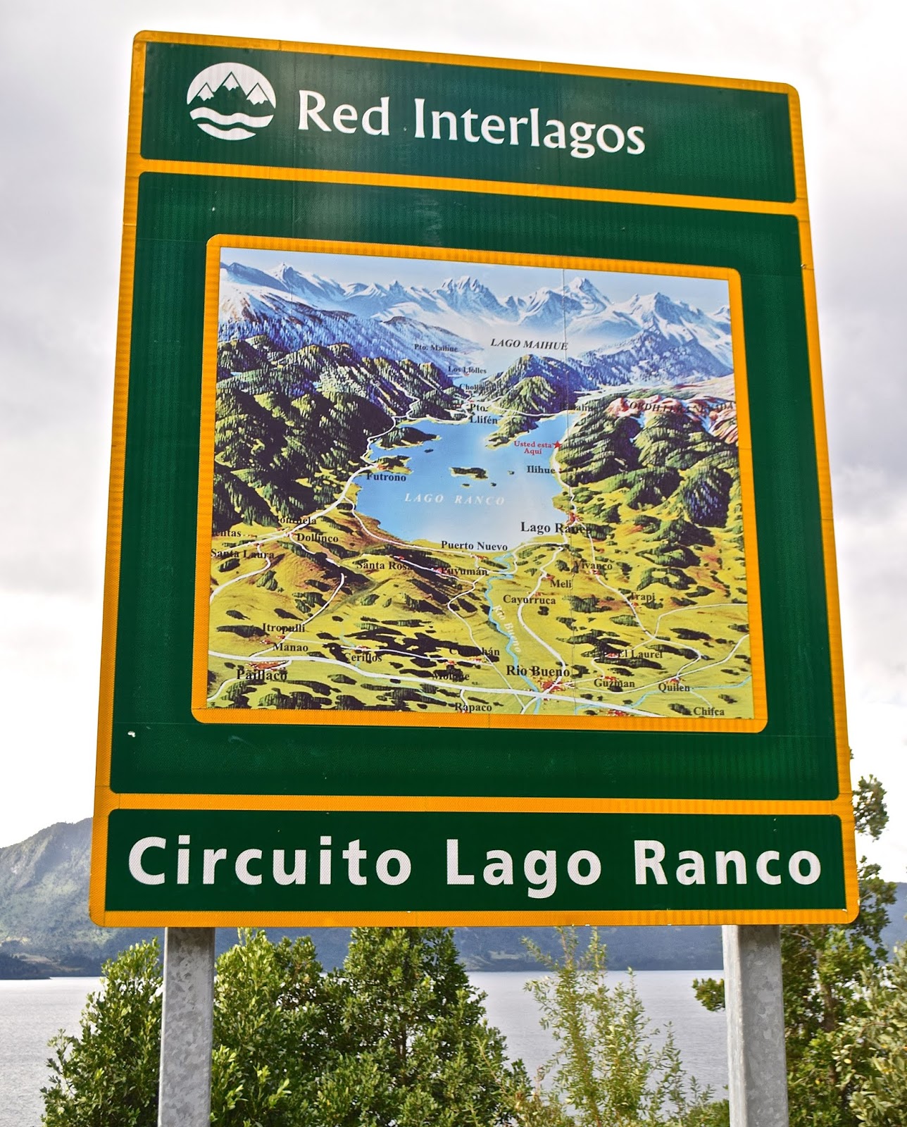
New highway signs mark the Red Interlagos.
Not so long ago, that wouldn’t have been possible but, in recent years, the Chilean government has linked and improved a series of roughly parallel easterly roads that provide a more scenic alternative along the lakes of the Andean front range. The Red Interlagos stretches from the town of Inspector Fernández, north of Temuco, south to the village of Puelo, southeast of Puerto Montt. I recommended an itinerary to my client and, when I next returned to Chile, I decided to follow the route—more or less—myself. It bears mention that the Interlagos is not a single highway, but a network of interconnected routes that pass through smaller towns and villages, not all of which are resorts, so there are multiple options.
Roadside frontage of the Hotel Awa
My client started in Puerto Varas and so did I, spending a couple nights in the new design Hotel Awa, a multi-story concrete, glass and girder structure on the city’s eastern outskirts. With views over Lago Llanquihue to the perfect cone of Volcán Osorno, it’s the area’s most technologically sophisticated hotel, but with rustic touches such as hiding the TV in an old steamer trunk at the foot of the bed. At night, I dined on truffled pork loin, complemented by a barley-based risotto from its own vegetable garden and garnished with a hazelnut sauce.
Grounds of the Museo Colonial Alemán, Frutillar
From Llanquihue’s south shore, there are two ways north, on the west side via Frutillar or the longer east side route via Ensenada. At the former, there’s the remarkable Teatro del Lago and the outstanding Museo Colonial Alemán, a tribute to German colonists that reminds me of in situ museums in Scandinavia.
A cycling event on the easterly route along Lago Llanquihue, beneath Volcán Osorno 
Puerto Octay, on Lago Llanquihue's north shore
I chose the longer route, which offers a detour up to the volcano’s ski area, which is open for hikers in summer, and then proceeded to picturesque Puerto Octay, a small north shore town with a metal-clad church and turreted houses that evoke Mitteleuropa. On Octay’s outskirts, my choice for the night is Hostal Zapato Amarillo, a Swiss-Chilean B&B with sod-roofed cabins, personalized attention, and fine dinners.
Hostal Zapato Amarillo is a cluster of sod-roofed guest rooms just outside Puerto Octay.
Hotel Termas de Puyehue is one of Patagonia's grand hotels.
For my client, though, I recommended continuing to Hotel Termas de Puyehue, a classic grand hotel at Parque Nacional Puyehue, about an hour north of Octay on the highway that runs from Villa La Angostura to Osorno. For visitors coming from Argentina, this sprawling hot springs hotel, with nearby hiking trails, makes an ideal overnight or multi-day stay in what may be the closest analogue to Bariloche’s Hotel Llao Llao. Along this highway, there’s still abundant evidence of the 2012 Puyehue-Cordón Caulle eruption that covered much of the area in ash.
Volcanic ash still covers parts of the shoulders along the highway between Argentina and Chile.
North of Entre Lagos, parts of the route are still unpaved but being improved.
I didn’t stay at the Puyehue this time, instead heading north through the town of Entre Lagos toward Lago Ranco, a lesser visited destination in the heart of Mapuche country. Along this segment, the Interlagos road signs say “Norpatagonia,” and, on a gravel surface with signs of improvement, muddy potholes splashed water onto my windshield. As I approached the south shore town of Lago Ranco, I could spot Isla Huapi, an offshore island inhabited almost exclusively by Mapuches.
The route around Lago Ranco is completely paved.
Here, in an area far more popular with Chileans than foreigners, I stopped for a sandwich before continuing east along a smooth paved road with plenty of scenic overlooks. The last time I had visited, a cable barge was the only means of crossing the Río Nilahue, but now modern bridges ease the route around the densely forested east side to the north shore town of Futrono. Here, almost opposite San Martín de los Andes, I spent the night at the Cabañas Nórdicas, a cluster of spacious and seemingly Scandinavian structures on a bluff overlooking the lake.
Sunset over Lago Ranco from my accommodations at Futrono
North of Futrono, the route’s a bit better trod, approaching the Ruta 5 town of Los Lagos but then veering northeast to Panguipulli, the entry point to a “Siete Lagos” route that resembles Argentina’s in Río Negro and Neuquén. Panguipulli fancies itself the "City of Roses" for its gardens at the east end of its namesake lake, but the area’s big attraction is its hot springs resorts. My client raved about the Zen-inspired Termas Geométricas—an isolated canyon of waterfalls, creeks and naturally heated pools linked by boardwalks near Coñaripe that’s open for day visits only—in the shadow of the fuming Volcán Villarrica.
The Termas Geométricas is a secluded hot springs venue south of Pucón.
Volcán Villarrica, as seen from Pucón, on the opposite side of Termas Geométricas
After a leisurely day at the Termas Geométricas, nearby accommodations options include the
Termas de Coñaripe—a hot springs hotel in its own right—and the town of Lican Ray, with its black sand beaches at Lago Calafquén. Termas Geométricas, though, gets many day-trippers from Pucón, the uber-resort city that’s just over the hill (mountains, that is) on Lago Villarrica. There, the place to stay is the hillside Hotel Antumalal, a Bauhaus-inspired masterpiece that, arguably, set the stage for Varas’s Awa. Still, there are many cheaper but still outstanding options here, and great hiking in spots like Parque Nacional VillarricaParque Nacional Huerquehue, and the Santuario Cañi, a private conservation effort aimed at protecting the area’s Araucaria forests.
Queen Elizabeth II and other big names have stayed at Pucón's Hotel Antumalal.
At Parque Nacional Huerquehue, the Sendero Quinchol leads to dense upland forests of Araucarias and southern beeches.
For visitors from Argentina, it’s easy to return by the Paso Mamuil Malal to Junín de los Andes and thence to Buenos Aires or back to Bariloche. The road goes on forever.

Thursday, April 23, 2015

Johnny Cash at Calbuco? Chile's Ring of Fire Erupts Again

In my academic field of geography, one of the specialties is natural hazards, a topic which was never central to my own research but which always attracted my attention. I grew up in the Pacific Northwest, where we felt the massive Alaska earthquake of 1964 and the cataclysmic eruption of Mt. St. Helens in 1980 (though I had moved away by then, a friend in Seattle, 96 miles to the north, told me that he thought the sound was someone slamming his front door very hard). I’ve lived through many earthquakes in the Bay Area, most notably the 1989 Loma Prieta (World Series) event.
And, of course, I’ve spent plenty of time in Chile, which has given me the opportunity to write about earthquakes, tsunamis, volcanic eruptions and floods (especially in recent weeks). Now, near the southern mainland city of Puerto Varas, one of my favorite Chilean destinations, the 2,003-meter (6,570-ft) Volcán Calbuco (pictured in the BBC video above) has upstaged the more northerly Volcán Villarrica, about which I wrote only recently.
In fact Calbuco (pictured above in quieter times) was one of my backup climbing choices after the recent closure of Villarrica to climbers, but I never actually made it Varas this last summer (though I passed nearby en route to Puerto Montt for the ferry to Puerto Natales). After Calbuco unexpectedly blew yesterday, I wrote my German friend Andreas La Rosé of Puerto Varas’s Casa Azul hostel to ask the effect there, and he seemed unconcerned: “Until now we have south wind and no rain. So no ash! In the moment everything is fine!”

That, however, was not the case for residents of Ensenada, a picturesque town at the east end of Lago Llanquihue. From Puerto Octay, on the north side of the lake, Armin and Nadia Dübendorfer of Hostal Zapato Amarillo wrote me this morning that “the volcano has settled down for the moment. The Ensenada area is seriously affected and was evacuated yesterday afternoon. Last night there were tremors and [a second] eruption was powerful, with thunder and lightning, the column of ash red with reflection from the lava.”

My friend Franz Schirmer, a Swiss-Chilean who owns Petrohué Lodge about 20 km east of Ensenada, sounded almost non-plussed: “Lots of noise, sand, ash and a spectacular lightning storm last night. Everything’s fine and now we’re working on removing the sand…” Interestingly, he referred me to his Twitter account, which included photos of him and his children at Calbuco’s crater two weeks ago; I wonder when – if ever - I’ll get that opportunity to do that hike.


Meanwhile, most of the ash seems headed eastward and, across the Argentine border, the residents of Bariloche are preparing themselves for an ashfall that could match that of the Cordón Caulle eruption of 2011. That could affect the upcoming ski season, as it did then, and air traffic to and from Argentine Patagonia.

Tuesday, February 17, 2015

On the Road Again? Southbound from Santiago

After a frustrating time in Santiago, where an overpowering virus of some kind kept me confined to a friend’s house – I don’t think she expected to spend nearly two weeks as my nurse – I was finally able to hit the road on Sunday, though I only made it as far as Talca, about 250 km south of the Chilean capital. The best thing was that I was able to spend a night at Casa Chueca, one of my favorite accommodations in the entire country – occupying a former vineyard, it’s spread over a park-like environment of seven hectares that was a welcome respite from the red-hot streets of Santiago.
Then, yesterday, I continued to Pucón – a longer drive but, the farther south I got, the weather continued to cool, though it was still very summerish. From my window at Hostería ¡École!, I have an obstructed view of Volcán Villarrica, which is presently closed to climbers, but barely any wisps of smoke are visible around the crater.
I’m only passing through here, en route to Puerto Montt to catch the Navimag ferry to Puerto Natales on Friday, with a brief stopover at Puerto Octay. For the moment, though, I’m going to post some observations on driving in Chile from the roughly 750 km I’ve driven in the past couple days. Some of this is anecdotal, so bear with me if I sometimes oversimplify.

1) Compared to Argentine drivers, many of whom are very aggressive, Chilean drivers are relatively sedate, but that can have its downside. Where there are three lanes on the freeway, the slowest drivers often occupy the middle lane, which means that faster drivers go around them on both sides. Where there are two lanes, they sometimes choose the fast lane; this is not something I adapt to easily, so I can’t afford even a short lapse in attention.

2) At this time of year, many young Chileans take to the road, but not many of them have cars – instead, they are hitchhiking, often in very dangerous spots alongside the highway. Given that I have hitchhiked these roads myself, longer ago than I care to admit, I sympathize with them but I rarely give anybody a lift now. They often travel in groups of three or even more, and think that I have plenty of room in my SUV, but I don’t – it’s full of books, papers, baggage and tools, or at least that’s my rationalization.
3) Some time ago, I wrote about the irony that, in Chile’s roadside servicentros, WiFi was usually free but they charged to use the bathrooms – usually a nominal fee, but there was always a person to collect before you could enter to relieve yourself. Fortunately, that appears to have ended; presumably, Copec, Shell and Petrobras have decided that their gasoline sales and concessions now pay well enough to subsidize the cost of cleaning the baños, and that people will make additional stops for convenience. That’s a win-win, in my opinion.


4) This has been a tough fire season, not unusual in the Chilean summer, but it was most notable in the Araucania region just north of the regional capital of Temuco. Near the town of Mulchén, where the native Mapuche have long been vocal about land claims and there have been instances of arson in the past, large stands of eucalyptus and Monterey pine – non-native commercial timber species – were virtually denuded. The eucalyptus have a chance to resprout, but the pines are likely to be a total loss.

Monday, January 13, 2014

Llanquihue's Forgotten Lakeshore

Shaped roughly like an equilateral triangle, Lago Llanquihue is one of southern Chile’s most visited areas, thanks to towns like Frutillar, with its Germanic charm, and Puerto Varas, with its distinctive architecture, exceptional accommodations and fine restaurants. Both enjoy panoramas of Volcán Osorno, its snow-topped cone mimicking the perfection of Fujiyama.

For more than a century now, the bus-boat shuttle from Varas across the Andes to Argentina has been a cornerstone of the local economy, but there’s another part of the lake that gets too little attention: from Puerto Octay, at its northern tip, a newly paved road follows the lakeshore southeast to reach the hamlet of Ensenada, where it meets the road from Puerto Varas.

For a couple decades, I’d seen this road on the map but until a few years ago I had never driven the length of it – clearly it was scenic, but it was narrow, slow and mostly loose gravel. I often received letters from cyclists who told me about battling tábanos, the large but harmless horseflies that buzzed them as they pedaled up the hills (Except in early summer, when the flies are numerous, the road makes an ideal cycling route).
Now that the road’s completely paved, though – other than one graveled stretch of just 300 meters – I decided to drive it again on a Friday afternoon in December. I started from Puerto Octay, where the density of German-style architecture may be greater than in either Frutillar or Puerto Varas – I loved the historic Hotel Haase, with its second-story wrap-around balcony. Beneath its steep-pitched roof, the arched interior of the Iglesia San Agustín displayed glistening woodwork and walls.
I didn’t eat in town, but made a brief stop at the Casa Ignacio Wulf, another architectural landmark where Lácteos Octay lets visitors sample the cheeses at their retail outlet. Then I hit the highway to the southeast, foregoing the first paved segment to take a shorter gravel road along the lakeshore at Maitén, with Osorno’s symmetrical cone never out of sight. Just two days after Christmas, it was a balmy if breezy day, but only a handful of locals were enjoying the black sand beaches – in a week, though, they’d likely be packed.
Beyond rows of conifers that yielded volcano views, the route continued through a dairyscape of Guernseys and close-cropped pastures to Puerto Fonck – one of numerous small ports that dotted the lakeshore in the days when even gravel roads were a distant dream. I stopped to see the steepled German church and restored graveyard, where all the tombstones bore surnames like Galle, Konrad and Opitz, before intersecting the paved road at Puerto Klocker.
At Klocker, there’s a gravel turnoff to La Picada, where a good footpath lets hikers traverse the volcano’s northwestern flank to arrive at Petrohué, on Lago Todos Los Santos, where the catamaran crossing to Argentina starts. The paved route continues to Las Cascadas, a second-home beach community where I had hoped to lunch but, in the limbo period before New Year’s, I could barely find an open grocery for a chocolate bar that had to suffice until dinnertime.
Beyond Las Cascadas there’s no public transportation, but the newly paved road – with a wide bike lane - hugs the shoreline even through some very rugged areas such as Abanico, where a cantilevered bridge overhangs the lake. At a wider spot in the road, I pull off onto a wide spot and walk back to the bridge, where two Brazilian cyclists have arrived from Ensenada but decide to turn back because the tábano attacks are increasing (you can’t swat them when you’re on a bicycle, without risking a fall). Other cyclists, though, continue to speed past me on the downhill segment toward Las Cascadas.
Another reason I stop is because the road cut reveals an outcrop of columnar basalt, similar to others I’ve seen at California’s Devil’s Postpile and Wyoming’s Devil’s Tower. Abanico can’t match the size of those, but its distinctive polygonal landforms continue to fascinate me, even as I brush away the tábanos.


Beyond Abanico, the road soon enters Parque Nacional Vicente Pérez Rosales, Chile’s first national park, and there are several new pullouts along the road for different panoramas of the peak, which looms closer than ever. While the lakeside road proceeds to Ensenada, a steep but narrow paved spur climbs the volcano’s flanks, sometimes passing through forest so dense it feels like a tunnel, before emerging onto a treeless ski area.

In summer, the lifts carry hikers into the high country but, if you don’t care to do so, there’s food at two restaurants, including the stylish new Nido de Cóndores (pictured above). Otherwise, at Ensenada, it’s a right turn back to Puerto Varas, or a left to Petrohué.
Custom Search